Drones and Aerial Surveying
The recent proliferation of drones over the last decade has been of growing interest to the ecological community as it has the potential to revolutionise the way in which animals and their habitats are monitored. Drones (unmanned aerial vehicle) are small, non-invasive devices that have the ability to carry out surveys in otherwise inaccessible locations and without interfering with sensitive environments.
Drones also have applications within the geological field, through erosion monitoring, geological mapping (including 3D photo-scanning geological outcrops) and creating interactive 3D models of geological features to assist with desk studies and reporting.
Drones and aerial surveying are best suited to the following applications:
- Aerial photography
- Aerial videography
- Digital surface models/elevation models
- Mapping sensitive features e.g. eroding/unstable cliffs
- Orthomosaics
- Assessing bat roost potential
We maximise efficiency and accuracy with this technology as it :
- Collects various different data sets in one site visit
- streams data directly to the Cloud for increased data security
- Provides aerial imagery to a resolution of 2.5mm
- Flies pre-programmed routes to produce high quality datasets in less time
Which means:
- Production of high quality geo-referenced data at high resolution, to help inform assessments
- Decreasing the risk to surveyors in hard-to-reach areas
- Efficiency in surveying due to smaller teams and fewer visits
Case Study
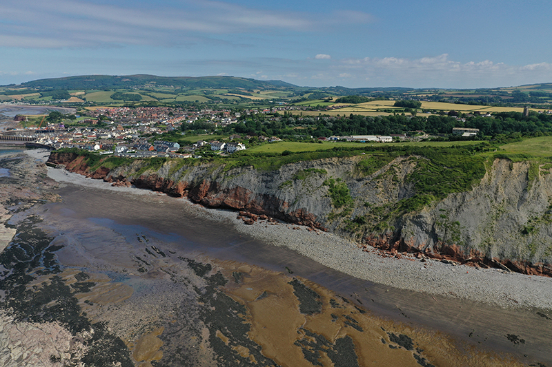
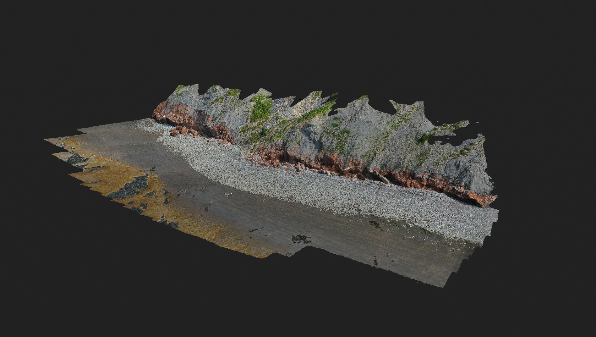
One example of how Geckoella has applied the use of drones is through mapping a sensitive geological Site of Scientific Interest (SSSI) near Watchet, Somerset, where a combination of tidal action, aerial weathering, drainage and the underlying geology all influence the rate of coastal erosion and cliff failure. Drone surveying was employed to record highly detailed aerial photographs of the site, in addition to orthomosaics that were subsequently used to produce digital elevation models. Interactive 3D models of the cliff face and foreshore could then be generated.
By using drones, we are able to capture high-quality, close-up photographs of the unstable cliff face without putting our surveyors or geological features at risk.
Quality Standards
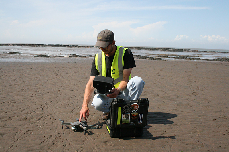
Geckoella drone surveys are undertaken by a commercially licensed drone pilot, with data processed in-house by experienced ecologists and geologists. Drone use is regulated by the Civil Aviation Authority (CAA) ensuring competence and safety awareness while operating drones.
All fieldwork methodology and reporting is carried out in compliance with CIEEM guidance.
Download our Drone PDF leaflet using the link below
Geckoella Drones in Ecology and Geology
View our interactive Drone Storymaps about Watchet and coastal development using the link below (any issues viewing in Safari try using Chrome)