Watchet: West Street Beach and Cleeve Hill
The striking red and blue cliffs at Watchet are an iconic landform, appreciated by local residents and tourists alike. From a geologist’s perspective, the cliffs and foreshore are of national and international significance with an excellent Upper Triassic succession and exposures of Lower Jurassic rocks. From Blue Anchor to Lilstock, the coastline has been recognised by Natural England (the government’s advisors for the environment in England) as hosting exceptional rock outcrops, and has subsequently been protected as a designated Site of Special Scientific Interest; the Blue Anchor to Lilstock Coast SSSI.
Like many UK coastal sites, the Watchet coastline is subject to continuous tidal erosion (with the 2nd largest tidal range in the world) and complex hydrological systems within the cliffs themselves. As a result, cliff subsidence, rock falls and landslides are a regular, and expected occurrence. Additionally, the effects of global climate change are expected to cause sea level rise, and accelerate coastal erosion processes in the future.
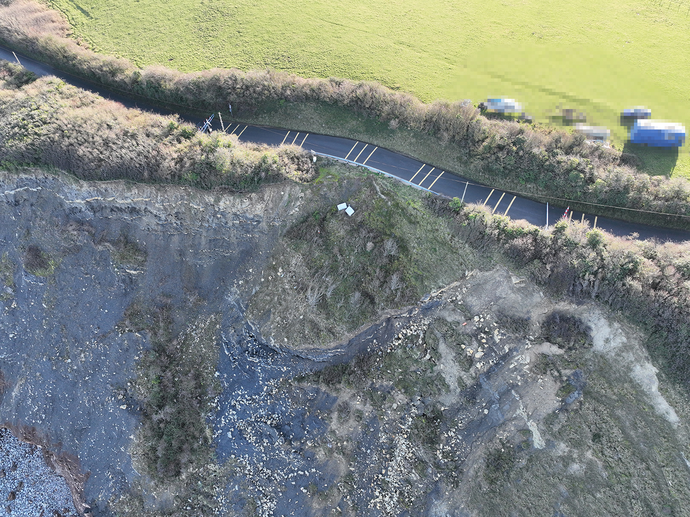
The B3191, known as ‘Cleeve Hill’ was closed by Somerset Council in January 2023. To regularly assess the situation, Somerset Council is carrying out targeting geotechnical and geological monitoring along West Cliff. As part of this, Geckoella – geological and ecological specialists based in Watchet -was tasked with completing geological and ecological surveys to improve the baseline understanding of the site. These surveys included two drone flights over the cliff/clifftop and foreshore area, geological mapping and a Preliminary Ecological Appraisal. The main aims of these baseline surveys are to:
- Identify changes through time using aerial drone inspections.
- Generate a comprehensive geological understanding of the site through geological mapping.
- Provide an up-to-date ecological understanding of the site including habitat mapping.
- Describe the suitability of those habitats for notable or protected species.
- Identify areas of conservation value within the site.
Geckoella drone flights are conducted by a Civil Aviation Authority (CAA) certified Remote Operator holding a valid GVC. Drone operations are carried out under an Operations Manual and a Preliminary Risk Assessment (PDRA-01), approved and authorised by the CAA.
Previous Work
Between 2022 and 2023, Geckoella worked closely with Watchet Town Council to monitor and assess an actively subsiding section of cliff below the West Street Allotments. A total of six drone flights were conducted, and documented the area of subsidence as it developed. The information from these surveys aided WTC in making informed management decisions, regarding the safety of members of the public accessing the allotments, using the West Street Residents Car Park and other nearby infrastructure.
Looking in detail, the rocks at Watchet record a dynamic time in Somerset, and the Earth’s history. The red triassic rocks were laid down in a hot, semi-arid environment around 210 million years ago, during this time, Watchet was closer to the equator and part of the supercontinent Pangaea. The Triassic Period ended with a mass extinction, giving rise to the ‘age of the Dinosaurs’ in the Jurassic. The Jurassic rocks at Watchet were laid down in a marine environment as sea levels rose around 200 million years ago – these rocks contain abundant ammonites, crinoids, bivalves and fossil wood.
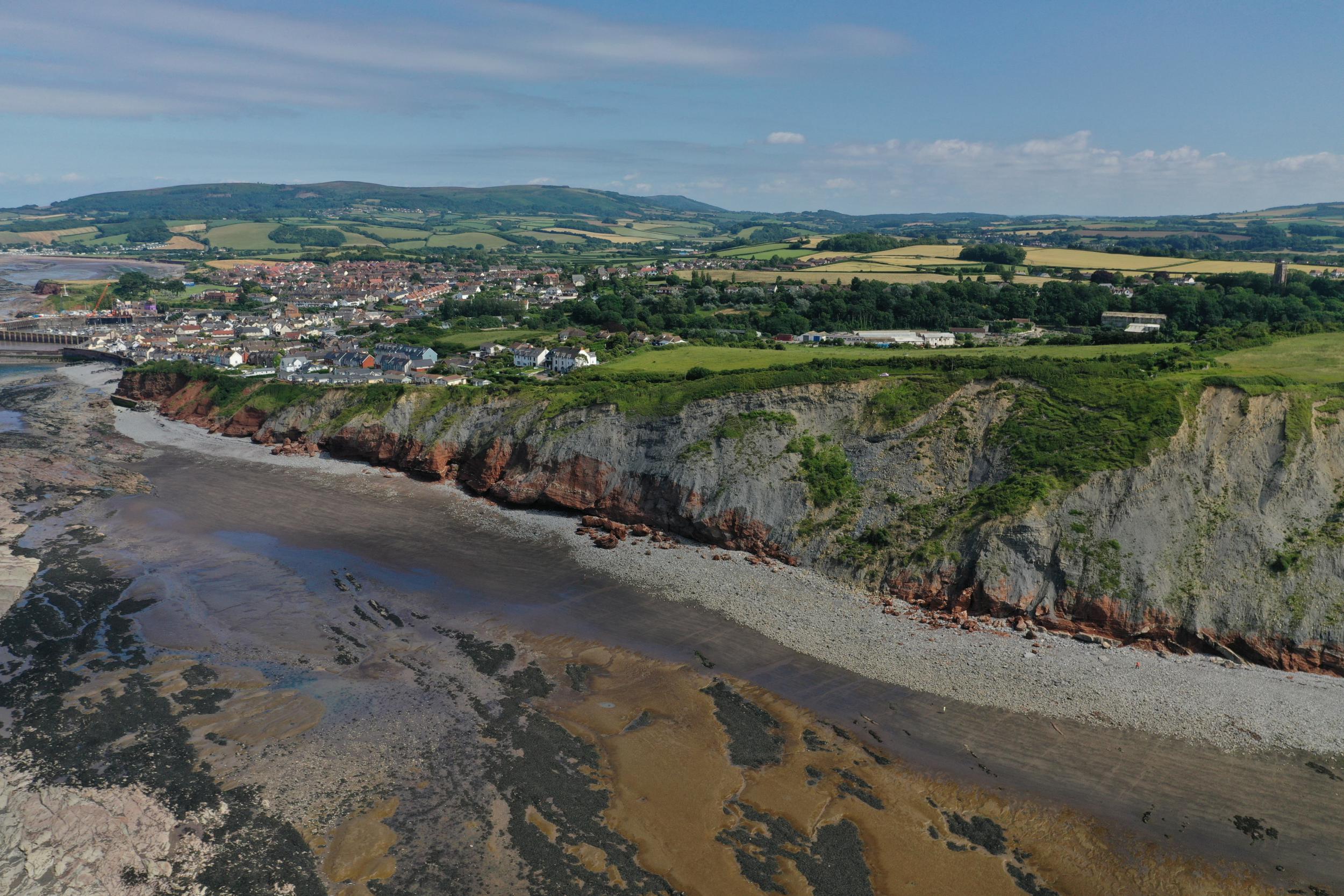
Aerial view of West Cliff and Watchet
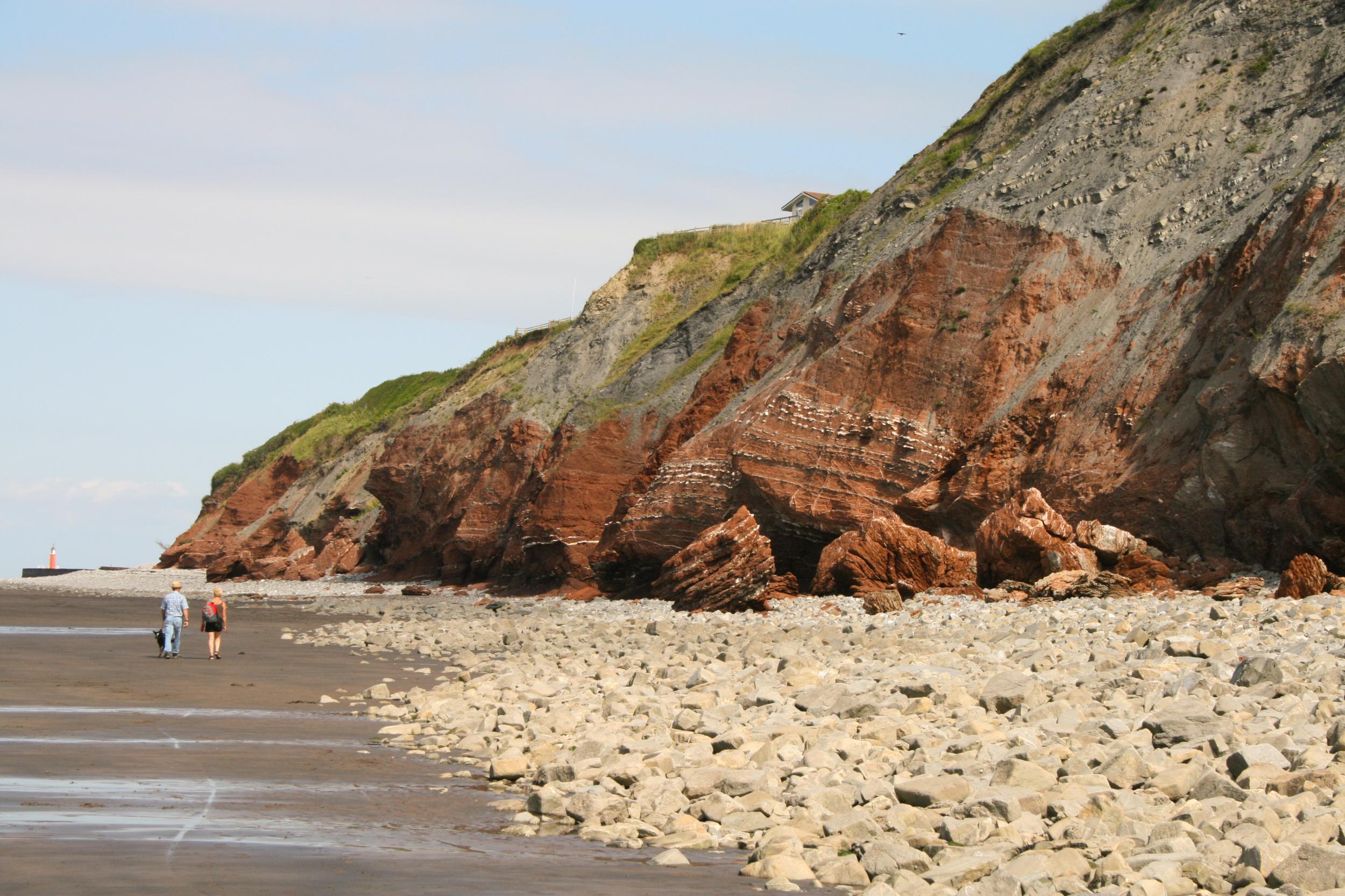
West Cliff beach with large fallen boulders of Triassic mudstone
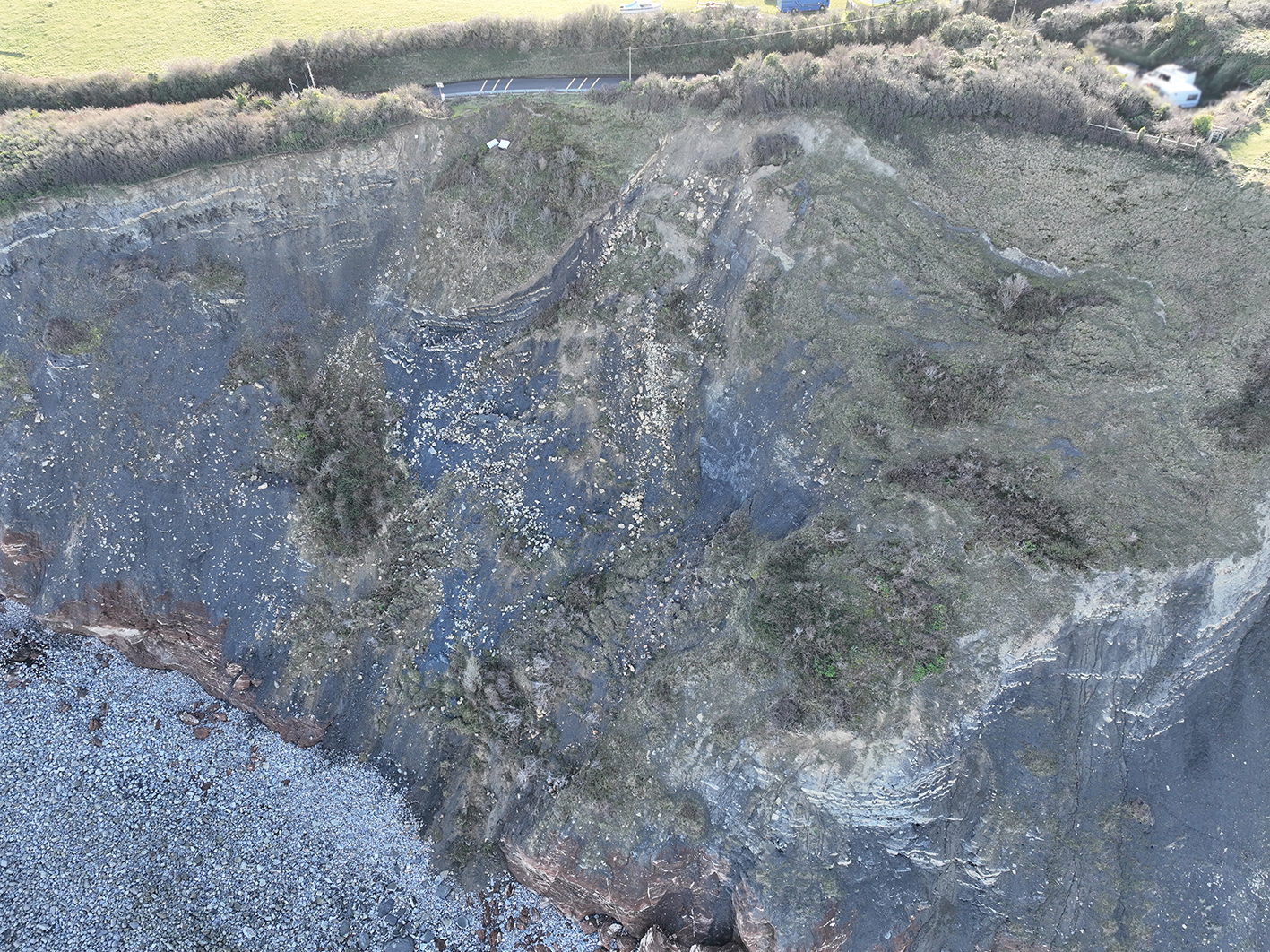
Aerial view of the Cleeve Hill geologically active zone